The Levada do Caldeirão Verde is one of the most popular levada hikes in Madeira, and with good reason. Featuring beautiful Laurissilva forest and some of the tallest waterfalls on the island, the PR9 is a must do hike for any avid hiker or adventurer.
Trail Details
- Difficulty: Moderate
- Distance: 13 km / 8 Miles
- Duration: 4 Hrs
- Elevation Gain: 150 M / 500 ft
The Levada do Caldeirão Verde is an easy to moderate, out-and-back levada hike in the beautiful Laurissilva forest near Santana in the north of Madeira. The trail covers a total distance of roughly 13 km (6.5 km each way). It takes most people around 3.5 hrs to complete, but it took us 4-5 hrs including lots of photo stops and a lunch break. It’s relatively flat and easy enough even for beginner hikers, though it’s worth knowing that some parts of the trail can feel a little exposed (but they’re well protected).
PR9 - Levada do Caldeirão Verde Map
Here’s a map of the PR9 – Levada do Caldeirão Verde hike. However, it’s worth knowing that the elevation graph for this hike is pretty inaccurate. The hike is relatively flat, starting at an elevation of around 870m and reaching approximately 1,020 metres at the furthest point along the trail.
Getting To The Queimadas Forest
The trail starts and ends at the Queimadas Forest Park about a 10-15 minute drive from Santana in the north of Madeira. Getting there is pretty easy as the Queimadas Parking Lot is registered on Google Maps and the park is well sign posted from Santana.
Parking at Queimadas is available for a small fee of around 5 euros per day. It’s a big car park and there are lots of spaces, though it can be busy particularly during the summer months and on weekends. We’d recommend getting there for an early start, which also makes the hike so much more enjoyable.
Trail Description
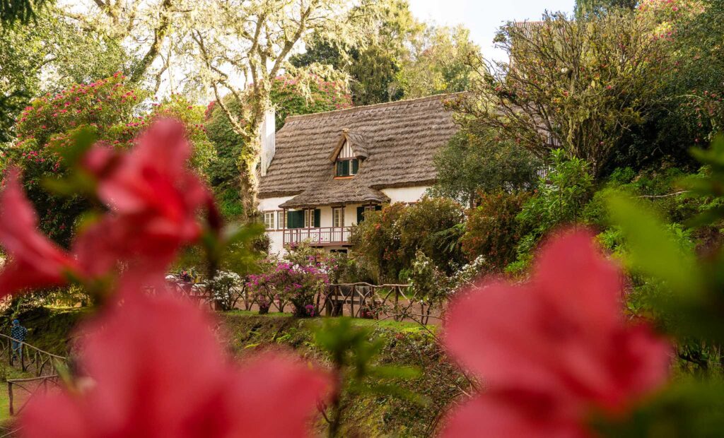
Starting at the Queimadas Forest Parking Lot, you’ll see clear sign-posts for the Caldeirão Verde hike (6.5 km) and the Caldeirão do Inferno hike (8.7 km). The trail will lead you past some iconic thatched houses from the 18th century, before turning onto a wide footpath that follows the levada canal (water irrigation channel).
Soon, the trail begins to narrow and you’ll drop down a set of steps before climbing them again shortly after. From there, the narrow trail continues almost completely flat alongside the levada and, in some cases, on top of the levada for the rest of the hike. At the 2 km mark, you’ll cross a bridge and encounter the first of several waterfalls.
Follow the path as it leads around the mountain and back into the next valley along. At around 4 km in, you’ll see a sign for the trail leading into the first of several tunnels. Take your to time to work your way through as the tunnels are often full of puddles and mud and are long enough to require a flashlight or head torch.
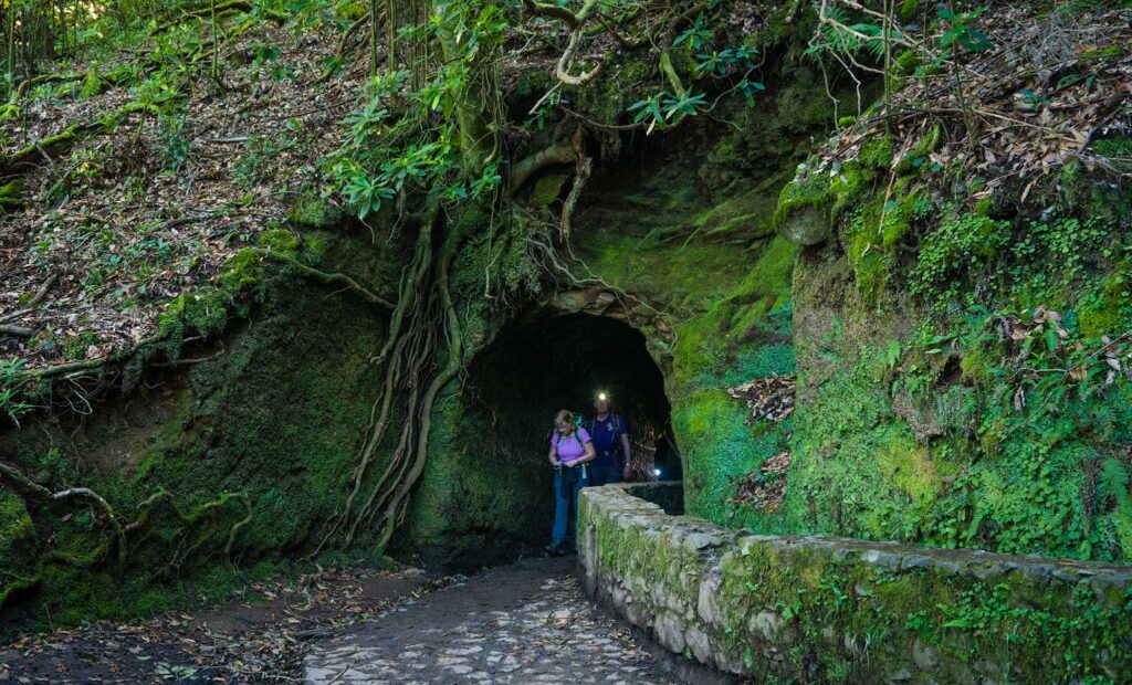
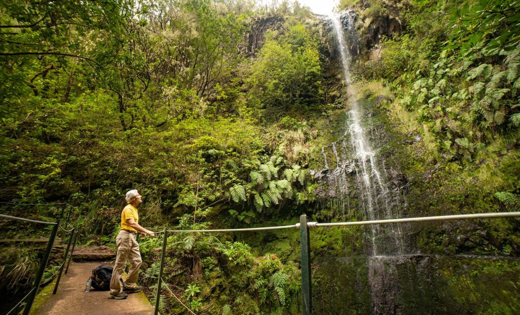
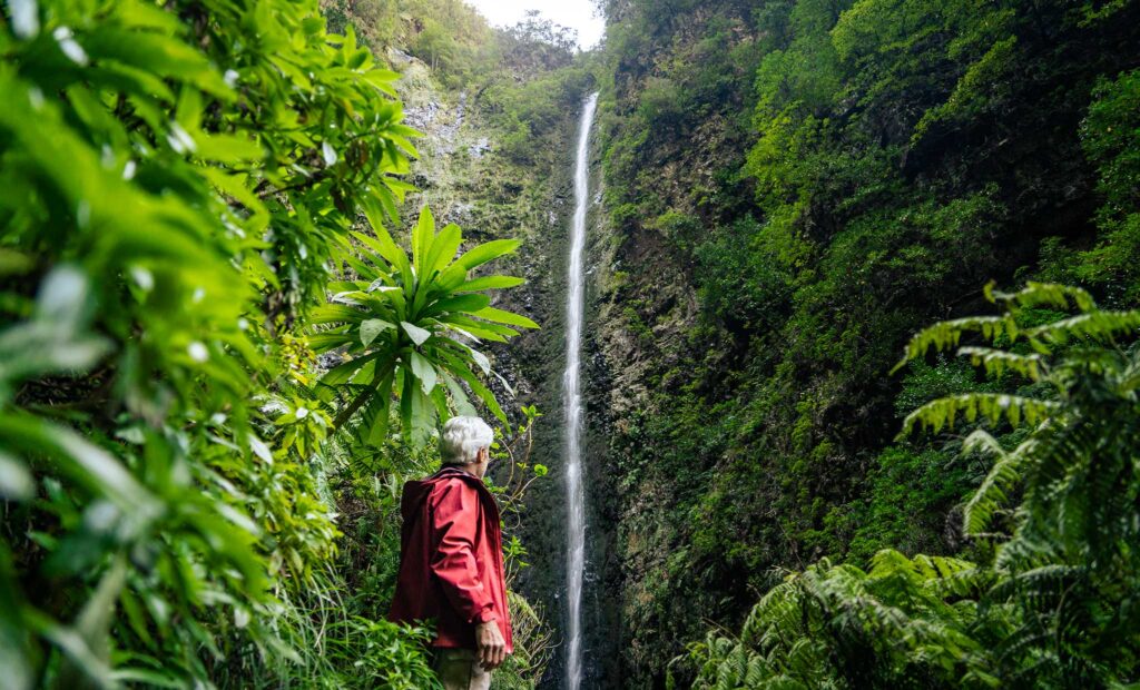
After that, you’ll wave in and out of the remaining tunnels as they lead you deeper into the valley with an increasingly steeper cliff to your right hand side. Suddenly, you’ll reach an opening where you’ll see a sign for a small footpath leading you to the base of the mightily impressive Caldeirão Verde waterfall tucked in the very back of the valley. Moments later you’ll reach the pool at the bottom of the almost 100 metre tall waterfall, which is a fantastic spot for a photo and lunch break.
From there, you’ll return the 6.5 kms back the way you came, passing the sign for the Caldeirão do Inferno hike which continues along the trail.
Once back in Queimadas, we’d highly recommend stopping off at the little café for some well earned coffee and cake.
Note: as far as we're aware, the Caldeirão do Inferno hike is currently closed due to a landslide on the path, making it unsafe to pass. If you follow the trail, you'll reach a blocked of section off the path clearly marking the trail as closed.
FAQs
Here are a few of the most common FAQs about the Caldeirão Verde waterfall hike:
Absolutely! The hike itself is pretty flat and well maintained. You should have no trouble with the walk as long as you’re ok with walking through tunnels and are ok with heights (some sections are a little exposed, but are well protected).
Well, the Caldeirão Verde waterfall. At almost 100 metres tall, it’s a breathtaking sight and the hike to it is easy enough that it’s accessible for even people who are relatively new to hiking. But the hike itself is also very enjoyable, with a bit of exposure and tunnels making it an adventurous hike for beginners too!
From Funchal, it takes a little under an hour to drive on the ER101 around the eastern side of the island. The road leads past the turn off to the Ponta de São Lourenço coastline which is well worth a visit on your way back.
We’d recommend waterproof hiking shoes or boots and a torch or headtorch for the tunnels. It’s also worth taking a raincoat or waterproof jacket too.